 Aragatsotn
 History
Aragatsotn is a winemaking region in Armenia, located in the West of the country. It has got the oldest winemaking traditions, claimed with both karases in Agarak and the cultivation of autochthonous grape varieties.
In the south-east the province borders with Yerevan, in the south – with Armavir region, in the north-west – with Shirak, in north-east – with Lori, in the east – with Kotayk. In the south the region borders with Turkey by a state border.
The territory of Araragatsotn has been populated since early Christian times. The valley of the river Qasakh has been well-known for its fertile lands and temperate climate. Investigations dating back to Stone and Bronze Ages claim these facts.
The first largest state that has mentioned this historical province in its chronicles is the Greater Armenia. Back then the settlement of Vardgesavan, which was renamed as Vagharshapat under the reign of Vagharsh I (117-140) and became the capital of the Greater Armenia. Later it got the name Echmiatsin (current Armavir region). In the Middle Ages, the northern part of Araragatsotn carried the name "Province of Amberd".
In the IX-XI centuries this part used to belong to Pahlavuni monarchy. In the XIV century the army of Temur looted and emptied the territory.
At the beginning of the XVI century, this province became part of Safavid Iran. In 1639 Aragatsotn became part of Erivan Khanate, and in 1828 joined Russia together with the regions of Eastern Armenia.
According to data, the province used to be the quite a large winemaking region in 3rd millennium BC. Until the 80s of XX century, Aragatsotn used to be the largest in the surface of vineyards.
 Terroir
The name of the region means “the foothill of Aragats”.
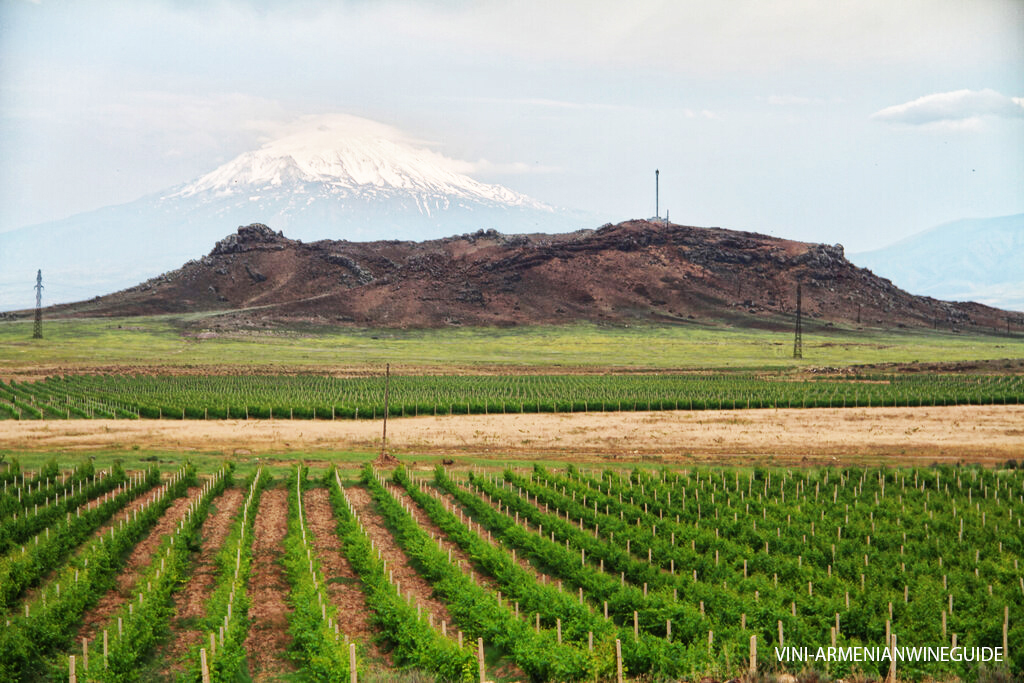
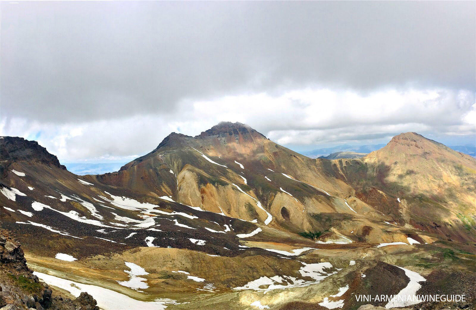
Aragatsotn occupies the north-western part of the physical-geographical region of Ararat: the massive of the Mount Aragats, ridges and slopes of Pambak and Tsakhkun mountain ranges, Aparan valley, the hight of Talin, including Arteni, Irind, Tsakhkasar and other volcanoes, as well as basins of upstream and downstream of the River Qasakh. The absolute altitude of the lowest point is 950 m, and the highest one is 4090 m above sea level.
The region is dominated with intermittent foothill and mountainous places, volcanic and erosional landforms. Pambak and Spitak mountain ranges connect the province with Lori region. Here there is the highest point of the Republic of Armenia – Aragats mount (4090m), extinct volcanoes Tsakhkasar (2219m), Irind (2050m) and Arteni (2047m) in Aragatsotn province. It is the only region in the Republic of Armenia, where all the types of terrain zones meet, dominating with the mountain - steppe, and mountain - meadow landscapes. In some places, there are also mountain-forest areas.
The river Qasakh rises in this region, together with its tributaries Shakhvard, Tsakhkashat, Gegharot, Amberd, Nigatun. While along the border with Turkey flows the river Akhurian.
There are rich deposits of basalt, andesite, tuff, perlite, volcanic slag, pumice and freshwater. Abundance springs exit in the steppes of Aragats valley.
The region is unique with its diverse climatic conditions. The average temperature and precipitation quantity can vary greatly depending on the altitudes. The average temperature on the steppe of the mountains during the warmest period of the year can be not less than 24 °C, while on the hilltops it is not more than 6 °C. In the territories closer to the hights of Aragats the number of precipitations reaches to 850-900 mm per year, while in lower areas (1000m) – 300mm. Closer to the Ararat valley summers are hot, and winters are moderate cool.
Vineyards are under a high risk of hailstorm at the end of spring and the beginning of summer.
The latest activities of volcanos are visible everywhere in these territories: the lands are literally strewn with volcanic stones of different sizes. The soil of the region is dark brown, based on volcanic remains – tuff, basalt, pumice, as well as there are carbonic soils, various types of limestone.
The unique terroir creates exceptional conditions for the cultivation of different grape varieties. There are heat addicted and frost resistant grapes, as well as late and early ripening cultivars adapted to this region.
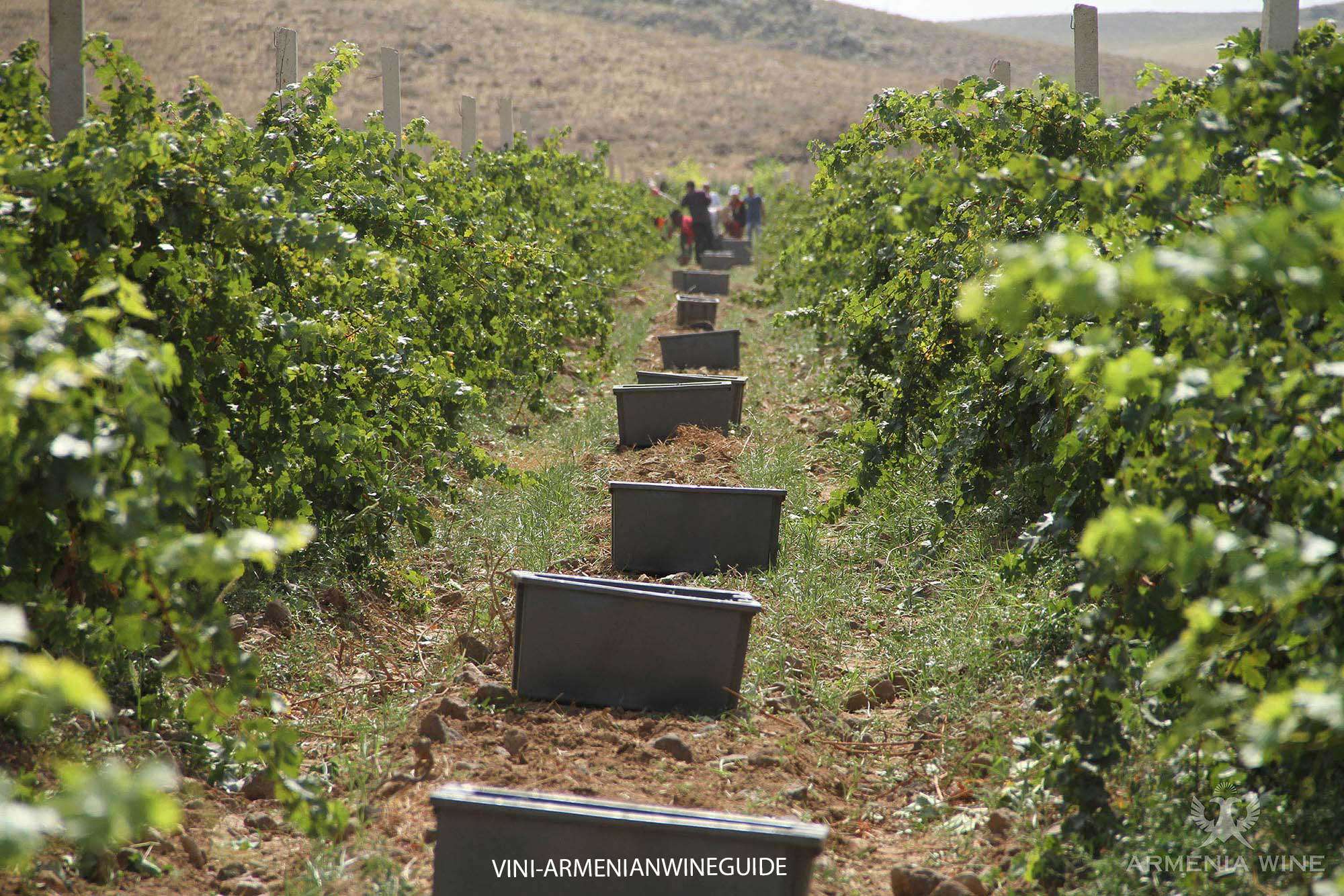
In the XX century, the terrace viticulture was actively applied in this region. However, today many vineyards were abandoned because of the lack of water for the irrigation.
At 1300 m above sea level there are small vineyards, burying 100-year-old vines. On the other hand, the modern vineyards are planted with European cultivars, and the vines grow on American rootstocks.
Phylloxera first appeared in this region in the beginning of 2000s.
Part of the vineyards is not covered for winter. Hot climate and quantity of frequent winds decrease the risk of fungi hazards.
The main grape varieties are Voskehat, Kangun, Rkatsiteli, Haghtanak, Karmrahyut and Areni Noir.
 Wineries
Several modern, large, family estates actively develop in the region: Armenia Wine Company, Van Ardi, Voskevaz Winery, ArmAs Golden Grape and Proshyan Brandy factory.